BEST APPS FOR NAVIGATION - SAILING FOLLOWTHEBOAT Q&A 24
Sailing 8 years ago 9,356 views
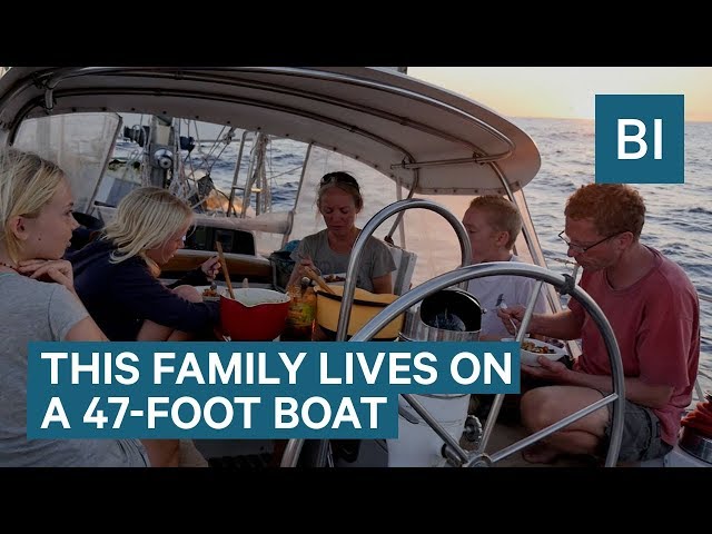
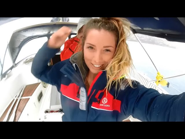
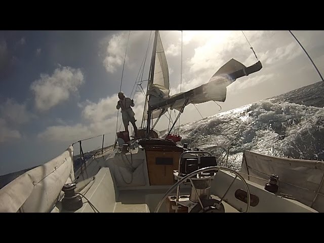
If you have any other suggestions, please put them in the comments, we'd love to hear your tips and advice for navigating where the charts don't go. 👍 If you enjoyed this video, please LIKE, COMMENT, SHARE & SUBSCRIBE, your feedback gets us noticed by YouTube and helps people discover us! Thank you. Some of the best places on earth are also the most difficult to navigate. If you don't want to rip off your rudder or open a hole in your hull watch this! We explain or on-board navigation system, the apps we use and the way in which we tackle this blue planets more challenging areas. There are a whole load of resources out there, so why not use them? We learned how best to tackle reef and bommie-strewn shallow waters in the Red Sea, then again in the Maldives and more recently in SE Asia. Charts just won't hack it in this kind of scenario, you need all your wits about you and senses on full alert to avoid a disaster...but it's worth it, because some of the places we've eased into have been simply spectacular. Fair winds and peaceful sailing! PS. After we recorded and posted this video Jamie received a thank you email from Navionics confirming that they have adjusted their charts for the Anambas. Hooray! --- 🔗 LINKS: NAVIONICS FOR ANDROID https://play.google.com/store/apps/details?id=it.navionics.singleAppUsaCanada&hl=en NAVIONICS FOR APPLE https://itunes.apple.com/us/developer/navionics/id294013906?mt=8 CMAP PLAN2NAV FOR ANDROID https://play.google.com/store/apps/details?id=com.jeppesen.plan2nav&hl=en CMAP PLAN2NAV FOR APPLE https://itunes.apple.com/us/app/c-map-plan2nav/id415917102?mt=8 TRANSAS iSAILOR FOR ANDROID https://play.google.com/store/apps/details?id=com.transas.uninav.plotter&hl=en TRANSAS iSAILOR FOR APPLE https://itunes.apple.com/us/app/transas-isailor/id398456162?mt=8 OPEN CPN https://play.google.com/store/apps/details?id=org.opencpn.opencpn_free&hl=en OPEN CPN WEBSITE https://opencpn.org/ OVITAL www.ovital.com/en/ ALL-IN-ONE OFFLINE MAPS FOR ANDROID https://play.google.com/store/apps/details?id=net.psyberia.offlinemapsplus&hl=en 🕮 E-BOOKS: 1. HOW TO BECOME A LIVEABOARD CRUISER! 2. HOW TO BUY A BOAT! https://followtheboat.com/product-category/publications/ --- 🛒 FOLLOWTHEBOAT SHOP: https://followtheboat.com/shop ✍️ SUBSCRIBE TO OUR WEBSITE FOR DISCOUNT CODES: https://followtheboat.com/contact/ --- 🙏 SAY THANKS THROUGH THE RUM FUND! http://followtheboat.com/THANKS/ 🙏 SUPPORT US ON PATREON! https://www.patreon.com/followtheboat --- LET'S CONNECT! 📷 INSTAGRAM http://www.instagram.com/followtheboat 👯 FACEBOOK https://www.facebook.com/followtheboat 📱 TWITTER https://twitter.com/followtheboat 🌎 FTB WEBSITE http://www.followtheboat.com 📧 JOIN OUR MAILING LIST: http://bit.ly/GET_EMAILS --- OUR GEAR: 📷 NEW CAMERA (Ep 68 onwards) Panasonic GH5 https://www.youtube.com/watch?v=7RdIZyP7OEE 📷 OLD VIDEO CAMERA (Ep 1 - 67) Olympus OMD EM-5 Mk2 http://amzn.to/2s6TA5F 📸 MAIN VIDEO CAMERA LENS Olympus Zuiko 12mm prime http://amzn.to/2s6w0WF 🚁 4K DRONE DJi Mavic Pro http://amzn.to/2rfI0qN 🎥 LIZ'S 4K CAMCORDER Sony AX53 http://amzn.to/2s6EQn3 🎤 MAIN EXTERNAL CAMERA MIC Rode VideoMic Pro http://amzn.to/2s6qeUL 🎤 LIZ'S CAMERA EXTERNAL COMPACT MIC Rode Video Micro Compact http://amzn.to/2rfpsXC 🎙️ MAIN EXTERNAL FIELD MIC Roland R-05 http://amzn.to/2rfpdMk 🎙️ SECONDARY EXTERNAL FIELD MIC Zoom H1 http://amzn.to/2qs6yNR 🌊 WATERPROOF CAMERA Olympus Tough TG5 http://amzn.to/2quDykH 🏂 MAIN 4K SPORTS CAMERA GoPro Hero 4 Black http://amzn.to/2quLF0F 🏂 SECONDARY 4K SPORTS CAMERA SJCAM 5000X http://amzn.to/2rfnVki 👩💻 EDITING SOFTWARE Adobe Premiere Pro CC http://amzn.to/2rfrkQ8ons --- 🛳️ FOLLOW OUR MOVES WITH MMSI/AIS http://www.marinetraffic.com https://www.vesseltracker.com MMSI number: 235026188


greatings Bjorn
10. comment for BEST APPS FOR NAVIGATION - SAILING FOLLOWTHEBOAT Q&A 24
Our Android devices come with built-in GPS, which doesn't require cell phone connection. I use Navionics all the time when my Android phone is offline.
It took us a while to work out that we had to pay for the facility to connect to Esper's wifi when using the iPad, and that's how we now get location on iSailor. A bit cheeky of Apple? Liz
I have the the AIS additional purchase which is great but need the ais data from the cellular so you have to be in mobile phone range for that. If you have a AIS receiver on board with wifi you can get an additional package for that to display on isailor (worth looking at if you buying a new ais that it can transmit data by wifi.) I also purchased the tide package which is also very useful for showing no go areas on chart.
Onething to bear in mind when recommending an iPad is that its only the ones with cellular capability has a built in gps receiver the others will give a position but only by cross referencing wifi towers so may work when you on terra ferma but not offshore I can vouch for the iPad gps but would not be confident with the gps on a cheap android. My experience is the isailor is much smoother on an iPad compared to android. Also on an iphone the sailor is only displayed in portrait mode not switching to landscape as per the iPad. I also connect my iPad to my tv with a hdmi and have a 22 inch plotter in the cabin which is fantastic for plotting routes together (imagine the cost of a 22 inch plotter).
My boat has the main plotter at the wheel and nothing down below which is where the iPad comes into its own. Finally the main plotter uses quite a bit of power so if spending a night at anchor its reassuring to set the anchor alarm on the phone or iPad which is very loud or just to take a reassuring glance at when turned in with the main plotter switched off.
In a nutshell the sailor is a great plotter without being over complicated and just works and does not feel like an app.
20. comment for BEST APPS FOR NAVIGATION - SAILING FOLLOWTHEBOAT Q&A 24
I do not agree that paper charts are not important, below will explain why they are so important and why the ability to read them correctly is so important.
I am a commercial skipper, i operate vessels for a living and have done for many years, whilst i understand some areas are not charted and are harder to navigate, I also understand that all information on electronic navigational devices is from surveying and geodesy, the same information is contained on charts, a datum is a reference system or an approximation of the Earth's surface against which positional measurements are made for computing locations. Horizontal datums are used for describing a point on the Earth's surface, in latitude and longitude or another coordinate system., Paper charts can be obtained in many different datums making sure you have the correct chart with the correct datum is paramount, being localisation is extremely important when it comes to charts, keeping in mind that all gps are in WGS 84, with Greenwich as the meridian which in itself is 100m out, so adjustments continually need to be made every year, this in it's self can lead to issues, if the datum for a local area is read from example NAD83, WGS84 may be out by up to 200 metres. Paper charts are no good if you do not read the notices to mariners and update the charts for the area you are navigating, Charts are measured at LAT, understanding this helps with navigation from charts but only if reading a chart with the correct datum or the correct offset applied.
Chart datums change but not on your GPS currently. You must work out weather you are in an area that is relevant to a localised datum or if it is suited to WGS84, or NAD27 CONUS, NAD 83, ED 50, AGD 66. or one of many others.
In relation to people entering information on Navionics the information entered from personal navionics will only overlay on their navionics as information provided by the general public can not be used for the purpose of charts. (as above)
When it comes to adding weighpoints to navionics it is easy, all you need to do is
search the lat and long then add to favourites and name it then it's saved. I think you would of read many times whether on Navionics or C-Map, etc, etc, that these are a guide only and not to be relied upon for navigational purposes.
With regards to using Google earth it may be helpful but you must understand that in areas of limited visibility in the water often it will not show dangerous shallow reefs. I have watched a couple of your video's, i watch many of the sailing video,s, one thing that does concern me is all of the people producing them are giving mixed signals to the general public and at some stage if someone follows this information and they run aground or worse, will they sue.
Please do not take what i am saying as negative, as i love seeing people out on the water and enjoying themselves, but i have rescued and towed many people in, who's dreams go out the door from a miss understanding of the water and its dangers. the most reliable navigation systems are charts and have been for hundreds of years, yes electronics has made it easier but it has not removed the use of charts completely yet and will not in our life time.
Enjoy your sailing.
happy sailing and be safe out there
30. comment for BEST APPS FOR NAVIGATION - SAILING FOLLOWTHEBOAT Q&A 24
With Navionics, it takes sounder information from boaters that have their sounders connected to a source that Navionics can read and updates the downloaded charts for everyone. Up here in Canada in the 30,000 Islands cruising grounds, there are rocks under the surface everywhere and the charts while half decent for the heavily covered channels are less useful when gunk holing. One of the beautiful things with Navionics is that because this is such a heavily travelled area by local cottagers who have loads of local knowledge, you get the benefit of their travels as long as they have depth information connected (most recent systems can put depth on the same bus as your nav signals and I'm putting a RS-422 - wifi bridge in so I can do it with my old pre 2K system as well. One thing you didn't mention (and perhaps part of the challenge you had with Navionics in the Anambas is to make sure that your nav system is using the same chart datum as the charts themselves. WG84 seems to be the more recent standard but there are thousands of charts out there with pre-WG84 datums and some are wildly off if your system is setup to read one and you are using another. In Canada many of our charts are NAD27 which luckily is pretty close but I've seen instances where there are deviations and you can get bit rather badly.
One thing for all of us to watch though is that Navionics was recently bought by Garmin so I'm worried they'll jack the prices and restrict the usability towards Garmin devices. One of the huge plus's for the Navionics on phones/iPads was the price... $20 for a region is awesome.
It has to be said Timezero is just amazing, with weather routing and weather overlay (and Active Captain crowd sourced information) along with the Furuno DRS4D-NXT radar which has doppler that colours oncoming targets red (including squalls) makes the stuff we used in the '90s quite prehistoric. I think I have enough electronic charts on board now to count as backup!
But... an old ex-admiral once said to me, "Paper charts still have the advantage over electronic charts in a war, notably if a paper chart gets shot at it will still work"
Well done. Love you videos.
a sensible approach speed is used in uncertain depths. Confused sea states when obstructions are not easily seen have you
ever used or possess a lead line ?
We don't have a lead line, we rely on our depth sounder in murky conditions. But a forward sonar/fishfinder is something we're considering. ✌️Liz
Hmm I do not view Ovital not being on G Playstore as being a problem. Imho that is great news :D I refuse to give google my cell number (had enough issues with them selling my yahoo email) or any other data if I can avoid it. If an app is not on my providers limited app store, or not available as download from sites web page, I simple do with out. Sadly a far too often occurence.
Also the all-in-one OfflineMaps, I noticed it had USGS as you scrolled down. That might have some really good US govt satellite images too. ESRI - intn'l supplier of GIS. From its website: ArcGIS, worlds most powerful mapping and spatial analytics software. From you it sounds like its really good. Anyway AWESOME video and thank you for sharing the info.
It took Navionics a couple of months, but as it was consistently out by the same amount we think that may been the reason. Liz
50. comment for BEST APPS FOR NAVIGATION - SAILING FOLLOWTHEBOAT Q&A 24
I was looking for free weather routing software and came across qtVlm. https://www.meltemus.fr/index.php/en/
I think it is well worth a look especially if you are planning a longer trip.
PS - you said you were heading north next. Any plans to make it to Samui? I ask, as I will be on Koh Samui for the next couple of months.
Hope this is useful to you - food for thought.
https://shop.runcam.com/runcam-night-eagle-2-pro/
Thanks for the videos. Always very informative. Cheers - David
(edit - Not crashing onto a reef obviously, but any close calls due to not seeing enough detail)
You'd think there'd be a feature whereby if you plot a course at a high zoom, and it takes you across an area where the depth is less than (say) 5m, it flags a great big warning, even if the object is not visible at that zoom level.